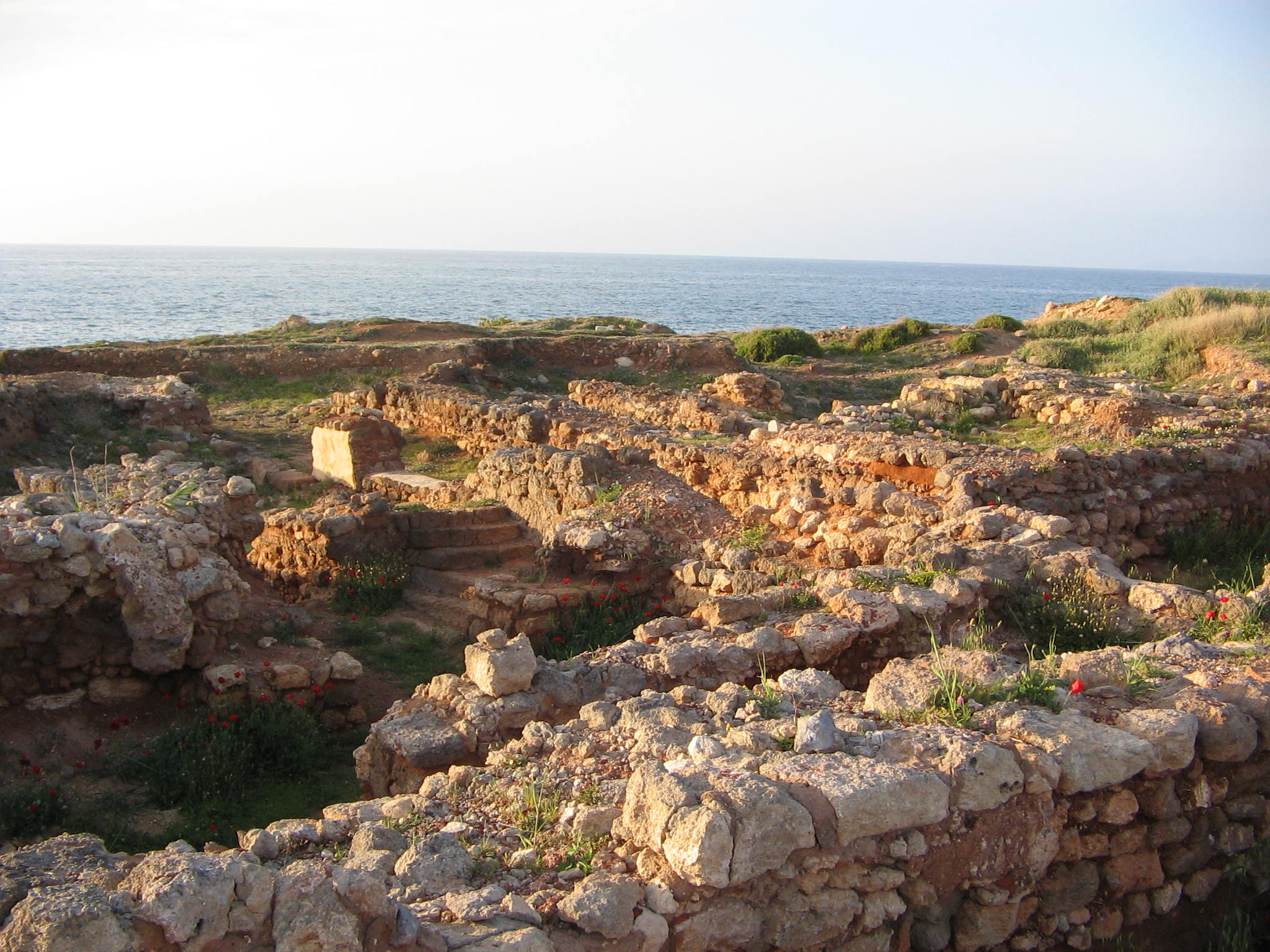
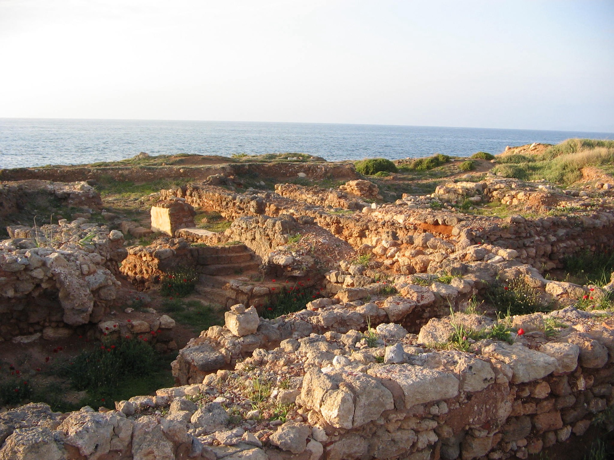
Ugarit: The Grand-place and the Merchant Quarter
Ugarit (Ras Shamra), Syria · Established c. 1400 BCE
This site requires authorization to access.
To request access, contact
william.goetzmann@yale.edu
The archaeological site of Tell Ras Shamra—ancient Ugarit—rises as a mound roughly twenty meters above the coastal plain of northern Syria, approximately twelve kilometers north of modern Latakia. The tell encompasses some twenty-five hectares of a walled city whose plan can still be read on the ground, its surviving foundations exposed by nine decades of continuous excavation under the Mission de Ras Shamra. To orient a visitor: the Royal Palace occupies the northwestern quarter and opens through a monumental gate to the north; the Acropolis with the temples of Baal and Dagan rises to the northeast; the Residential Quarter (Quartier Résidentiel) lies south of the palace and east of the Ville Sud; and the Ville Sud—the densely built South City that contains the merchant houses and the Grand-place—occupies the southern third of the tell, organized around an orthogonal grid of narrow streets and roughly rectangular building blocks called îlots. Marguerite Yon’s The City of Ugarit at Tell Ras Shamra (Eisenbrauns, 2006) remains the definitive synthesis of the layout; the site is divided in Yon’s grid into four lettered quadrants subdivided into ten-meter squares, a system that still governs publication. The Royal Palace itself is a monumental complex of roughly 6,500 square meters containing some ninety rooms organized around eight interior courtyards, with deep stone-lined drains, bathing rooms, and archival chambers. Eight distinct archives of cuneiform tablets were excavated within the palace, preserving more than a thousand texts in Akkadian and Ugaritic that record administrative transactions, trade agreements, diplomatic correspondence, and judicial rulings. South and east of the palace lay densely populated residential quarters whose houses were built of coursed rubble and ashlar masonry with timber lacing, rising typically to two stories, roofed with beams and reeds, and drained by stone channels beneath the streets. Alessandra Gilibert, in her foundational study “Urban Squares in Late Bronze Age Ugarit: A Street View on Ancient Near Eastern Governance” (Journal of Near Eastern Studies 80.2, 2021), identified five public squares in the excavated city and—using spatial-configuration analysis (visibility-graph modeling with depthMapX software together with contextual analysis of small finds)—distinguished one of them, the Grand-place or Central Square in the Ville Sud, as Ugarit’s marketplace, structurally separate from four ceremonial squares located at temple precincts (among them the Square with the Basin and the Square with the Vase). The Grand-place occupied approximately 800 square meters of unpaved earth at the topographic center of the city, where the main east–west and north–south streets converged and where the visibility graph confirms the highest integration value in the street network—meaning a person moving through Ugarit was statistically more likely to pass through the Grand-place than through any other open space. Surrounding this plaza rose the homes of Ugarit’s great merchant families. The house of Urtenu, south of the Grand-place, yielded the largest private archive known from the Bronze Age—some 650 cuneiform tablets including letters, accounting ledgers, and administrative texts documenting the export of copper, wood, and other goods, as reported in Archaeology Magazine (July/August 2021). The house of Rap’anu contained a private library of literary and diplomatic texts, while the archives of Yabninu and Rashap-Abu preserved further commercial records. One kilometer to the west, down a road across the coastal plain, the harbor settlement at Minet el-Beida (the “White Harbor”) served as Ugarit’s principal port, where warehouses, bronze-working installations, and rock-cut tombs have been excavated since Claude Schaeffer’s initial campaigns beginning in 1929. A second anchorage at Ras Ibn Hani, slightly to the northwest, complemented Minet el-Beida; excavations there uncovered the only oxhide ingot mould yet known from the Bronze Age Mediterranean, direct evidence of on-site copper processing. The discovery of Ugarit itself was accidental: in 1928 a farmer’s plow struck a stone-built tomb near Minet el-Beida, prompting investigations by René Dussaud that led to Schaeffer’s appointment as director of the Mission de Ras Shamra, which he led from 1929 until 1969. Yon succeeded him and directed the French mission from 1978 to 1998, producing the definitive archaeological synthesis of the site.
The decorative and material culture recovered from Ugarit’s commercial quarters provides vivid testimony to the cosmopolitan character of its merchant class. Among the most celebrated objects are the ivory carvings found in the Royal Palace and elite residences—panels depicting goddesses, mythological scenes, and ritual banquets that display a fusion of Egyptian, Mesopotamian, and Aegean artistic traditions. The Musée du Louvre holds a significant collection of these ivories, including carved cosmetic boxes and furniture inlays recovered from Schaeffer’s excavations, as documented in the museum’s Galerie d’Angoulême devoted to Eastern Mediterranean treasures. Gold pendants representing goddesses, bronze figurines of deities, and elaborately worked gold bowls and cups attest to the wealth concentrated in the merchant and royal precincts. Cylinder seals constitute one of the richest categories of trade-related art: a sealcutter’s complete toolkit was found at Ugarit, containing copper chisels, pointed gravers, a whetstone, a borer, and unfinished seals, as recorded in studies of Ugaritic glyptic art by Pierre Amiet (Corpus des cylindres de Ras Shamra-Ougarit, 1992). These seals, impressed onto clay tablets and bullae to authenticate commercial transactions, display Babylonian, Egyptian, Hittite, and local Syrian motifs—a visual index of the diverse trading partners with whom Ugarit’s merchants dealt. Stone weights recovered from the Ville Sud area are particularly significant for understanding commercial practice. A study presented at the “Ugarit: 90 Years Later” symposium at the Collège de France examined the weights of the Ville Sud in their archaeological and epigraphic context, revealing that Ugarit employed a system based on the shekel (with a “light” standard of approximately 9.5 grams and a “heavy” standard, designated kbd, used specifically for weighing purple-dyed textiles) and the talent of 3,000 shekels—a variant on the Mesopotamian system reflecting Ugarit’s distinct commercial norms. Imported Mycenaean and Cypriot pottery, found in abundance at both Ras Shamra and Minet el-Beida—Yon tallied some 670 Cypriot vessels across the site—served not merely as trade goods but as prestige items in merchant households, their painted decorations of chariot scenes, bulls, and marine motifs signaling the international connections of their owners.
Ugarit occupied one of the most strategically advantageous positions in the ancient Mediterranean world: a walled city of perhaps eight to ten thousand residents on a low coastal mound one kilometer inland, connected by a paved road across a grassy plain to its harbor at Minet el-Beida on a natural bay. Situated at the intersection of maritime routes linking the Aegean, Cyprus, and Egypt with overland caravan paths reaching deep into Mesopotamia and Anatolia, the city functioned as what Yon termed a “cosmopolitan Mediterranean capital.” A walker entering through the great northern Royal Gate (still standing today, its corbelled basalt pylons rising more than five meters) would have passed first into the Palace forecourt, then turned south past the palace’s service wing into the narrow streets of the Residential Quarter, and eventually emerged into the open light of the Grand-place in the Ville Sud. Streets at Ugarit were mostly two to three meters wide, surfaced with pressed earth, and drained by stone channels; the houses that lined them presented mostly blank ground-floor walls pierced by single doorways, with living quarters concealed above on the second story—a layout that gave the streetscape its characteristic quiet inwardness. The Grand-place itself was visually and acoustically the opposite: an unpaved esplanade of roughly 800 square meters at the topographic and movement-network center of the city, into which four or five major streets emptied, ringed by the multi-story houses of Urtenu, Rap’anu, and other merchant families. Alessandra Gilibert (Journal of Near Eastern Studies 80.2, 2021) demonstrated through visibility-graph analysis that this was the single most integrated and visible point in the city’s movement network—the place a Ugaritian was statistically most likely to traverse on any given day. The small finds recovered from its surface—trade-related objects, fragments of commercial pottery—together with the weight-rich archives in the surrounding houses led Gilibert to identify it as a marketplace and to distinguish it from four ceremonial squares located at temple precincts elsewhere in the city (among them the Square with the Basin and the Square with the Vase, each anchored by steles—including a Baal au Foudre—that marked the threshold of sacred space). The Grand-place thus appears to have been the closest Bronze Age analogue to a classical Greek agora that archaeology has yet recovered. The spatial separation of city and port, paralleled at contemporary sites such as Enkomi and its harbor at Toumba tou Skourou on Cyprus, reflected a deliberate urban strategy: the elevated tell provided defensibility and commanded views of approaching ships, while Minet el-Beida offered protected anchorage under the lee of Jebel al-Aqra (ancient Mount Hazzi) to the north. The city’s hinterland was richly productive, and the Orontes valley to the east provided access to the Syrian interior. Mario Liverani, in his foundational Storia di Ugarit (Studi Semitici 6, 1962), described the original bipartite social organization of the kingdom as comprising a royal sector controlling the means of production alongside a free rural sector that supplied agricultural surplus—grain, olive oil, and wine—through taxes and corvée labor. This hinterland surplus fueled Ugarit’s export economy. The overland route eastward through the Orontes corridor connected Ugarit to Emar on the Euphrates, a key node in the tin trade from Central Asia, while coastal shipping linked it northward to the Hittite vassal ports of Ura and southward to the Phoenician cities of Byblos, Sidon, and Tyre. Wilfred van Soldt, in The Topography of the City-State of Ugarit (AOAT 324, Ugarit-Verlag, 2005), reconstructed the administrative geography of the kingdom, identifying dependent cities and villages that together formed a polity of perhaps 25,000 to 30,000 people—a substantial population sustained by Ugarit’s role as a commercial intermediary. The city’s position at the frontier between the Hittite Empire to the north and Egyptian influence to the south gave it both diplomatic leverage and vulnerability, as its kings navigated between the great powers while extracting commercial advantage from their rivalry.
Ugarit’s history as a trading center stretches back to the Neolithic period, but the city reached its commercial apogee during the Late Bronze Age, from approximately 1400 to 1185 BCE. The cuneiform archives—comprising texts in Ugaritic, Akkadian, Sumerian, Hurrian, Hittite, Egyptian hieroglyphs, Luwian hieroglyphs, and Cypro-Minoan script—document an extraordinary network of international exchange. Alessandra Gilibert (JNES 80.2, 2021) dated the main phase of the Grand-place in the Ville Sud and its surrounding merchant houses to the thirteenth century BCE, on the eve of the Bronze Age collapse; in her analysis, Ugarit’s urban squares constituted a system in which one primary marketplace and four ceremonial spaces together regulated the balance between commerce, religion, and royal authority, making the city’s public space, in her words, an “organic, dynamic, and multiscalar system of intersecting interactions.” As Michael Heltzer demonstrated in Goods, Prices and the Organization of Trade in Ugarit (Reichert Verlag, 1978), the Ugaritic economy operated through a dual system in which the palace organized and partly financed trading ventures while private merchants (tamkaru) conducted commerce on their own account. The tamkaru of Ugarit were not merely royal agents: they could hold land, accumulate personal wealth, and negotiate individual exemptions from taxation. The case of Sinaranu son of Siginu, analyzed by Heltzer in a dedicated study (“Sinaranu, Son of Siginu, and the Trade Relations between Ugarit and Crete,” Minos, 1988), is paradigmatic—a royal decree exempted his ship, laden with grain, beer, and olive oil returning from Crete around 1260 BCE, from the standard royal tax on imports, acknowledging the merchant’s value to the kingdom. Kevin McGeough, in Exchange Relationships at Ugarit (Peeters, 2007), argued that the palace was not a top-down administrator of the economy but rather the most powerful actor within overlapping exchange networks, perpetuating its dominance through the “haphazard arrangement of receiving and distributing goods” rather than through centralized planning. Carol Bell, in “The Merchants of Ugarit: Oligarchs of the Late Bronze Age Trade in Metals?” (in Bentley et al., eds., 2012), showed that buying and selling raw metals was among the principal activities of Ugarit’s wealthy merchants, involving maritime trade with Cyprus for copper and overland acquisition of tin from the Euphrates route, with copper, tin, and bronze then reshipped by donkey caravan to inland Levantine cities such as Kadesh. Correspondence between Ugarit and the king of Alashiya (Cyprus) records specific consignments—King Kushmeshusha of Alashiya informed King Niqmaddu of Ugarit of his intention to send 33 copper ingots totaling nearly one tonne. The Amarna letters (EA 45–49), dating to the fourteenth century BCE, document Ugarit’s relations with Egypt under kings Ammittamru I and Niqmaddu II. Gregorio del Olmo Lete, in The Private Archives of Ugarit: A Functional Analysis (Edicions de la Universitat de Barcelona, 2018), provided an exhaustive study of the private archival collections that illuminate the social and economic functions of merchant households. The city’s end came swiftly. Around 1185 BCE, in the wave of destructions that Eric Cline analyzed in 1177 B.C.: The Year Civilization Collapsed (Princeton University Press, 2014), Ugarit was sacked and burned—probably by the maritime raiders known as the Sea Peoples. A poignant letter found in a kiln, apparently never sent (RS 19.011), describes the city’s final agony: “Our food in the threshing floors is sacked and the vineyards are also destroyed. Our city is sacked.” The destruction was so thorough that the site was never reoccupied, and the Grand-place, emptied of its merchants, lay sealed beneath the collapse debris until Schaeffer’s team began to expose it nearly 3,100 years later.
Ugarit’s archives and the archaeological record together document an extraordinary range of commodities that passed through its markets and harbor. Copper was the most important metal: imported primarily from Cyprus (Alashiya) in the form of oxhide-shaped ingots weighing roughly 29 kilograms each, it was either worked in Ugarit’s own bronze foundries or re-exported through its ports. The metallurgical tools recovered from Minet el-Beida—axes, sickles, tongs, and a spiral-handled foundry shovel closely paralleling implements from Enkomi on Cyprus—attest to the on-site processing of imported copper, as discussed in studies of Cypro-Ugaritic mercantile relations. Tin, essential for alloying bronze, reached Ugarit via the overland Euphrates route from sources as distant as Central Asia, as demonstrated by isotopic analysis of tin ingots from the Uluburun shipwreck (c. 1300 BCE), the cargo of which—ten tonnes of copper and over one tonne of tin—may have departed from a port servicing Ugarit, based on chemical analysis of the pottery aboard, as Cemal Pulak documented in excavation reports for the Institute of Nautical Archaeology. Purple dye from murex shells was one of Ugarit’s most lucrative products: crushed murex residues found at Minet el-Beida dating from the fifteenth to thirteenth centuries BCE constitute the earliest known archaeological evidence of purple dye production in the Mediterranean. Administrative documents record that the kingdom paid tribute to its Hittite overlords in purple-dyed wool, and the Ugaritic weight system included a special “heavy” shekel (kbd) designated for weighing dyed textiles, underscoring the commodity’s commercial importance. Textiles more broadly—dyed wool, linen garments, and finished fabrics—figured prominently in Ugarit’s exports. Agricultural products included grain, olive oil, and wine from the kingdom’s fertile hinterland, shipped both by sea and overland caravan. Timber, particularly Lebanese cedar from the nearby mountains, was exported to timber-poor Egypt and Mesopotamia. Luxury goods circulated in both directions: ivory (both raw and worked), lapis lazuli from Afghanistan, gold and silver, perfumes, and glass. Imported Mycenaean pottery—kraters, stirrup jars, and kylikes—arrived in significant quantities, as did Cypriot wares; Yon documented some 670 Cypriot vessels across the excavated areas of Ras Shamra, Minet el-Beida, and Ras Ibn Hani. The Cape Gelidonya shipwreck (c. 1200 BCE), excavated by George Bass in 1960, and the Uluburun wreck together provide material corroboration of the scale and diversity of seaborne trade in which Ugarit participated—a network linking the Aegean, Cyprus, the Levant, and Egypt in what William Goetzmann, in Money Changes Everything: How Finance Made Civilization Possible (Princeton University Press, 2016), characterized as a sophisticated system of international exchange underpinned by written contracts, credit arrangements, and negotiated partnerships between palace and private enterprise.