Commercial Harbor of Carthage
Carthage, Tunisia · Established c. 814 BCE
This site requires authorization to access.
To request access, contact
william.goetzmann@yale.edu
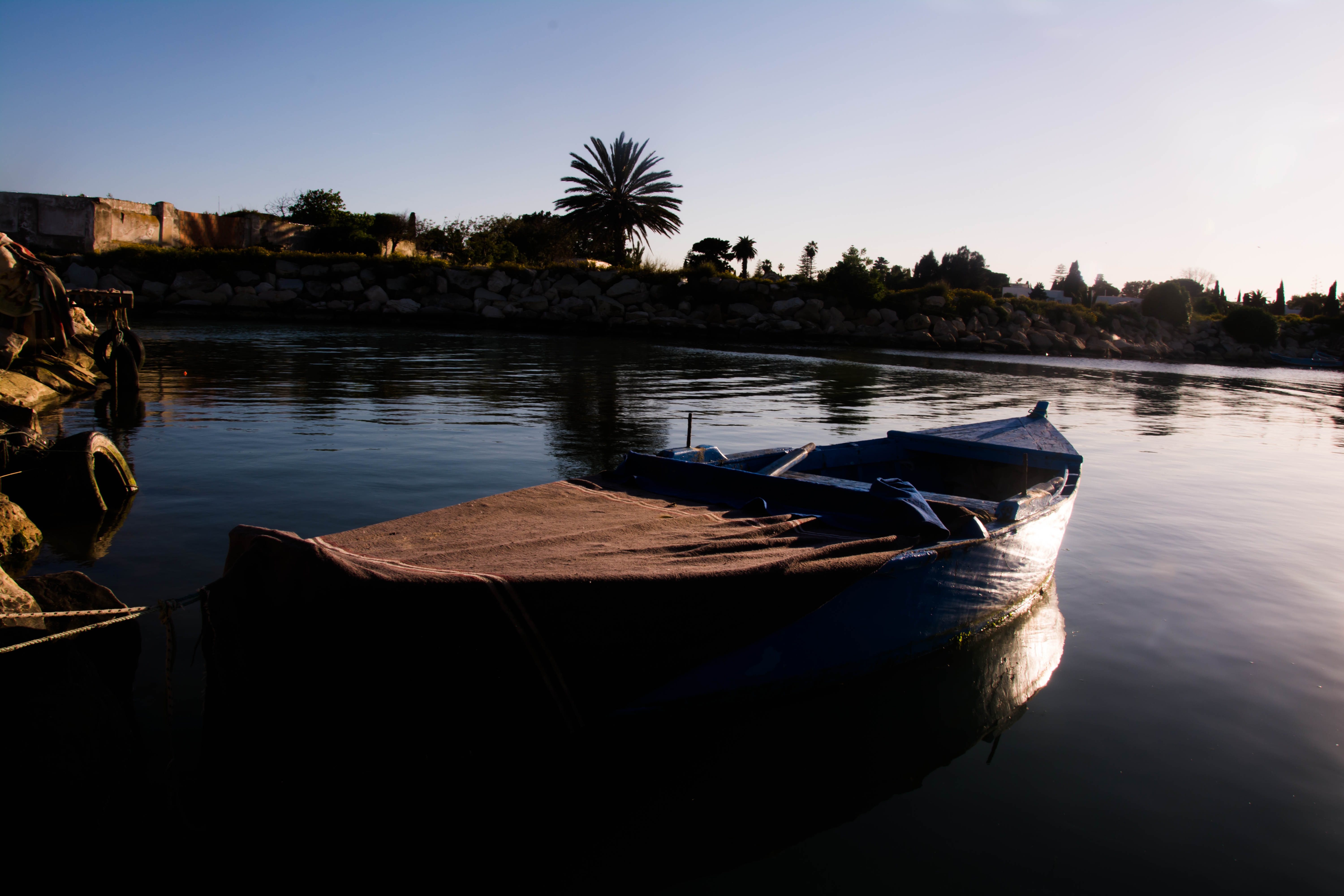
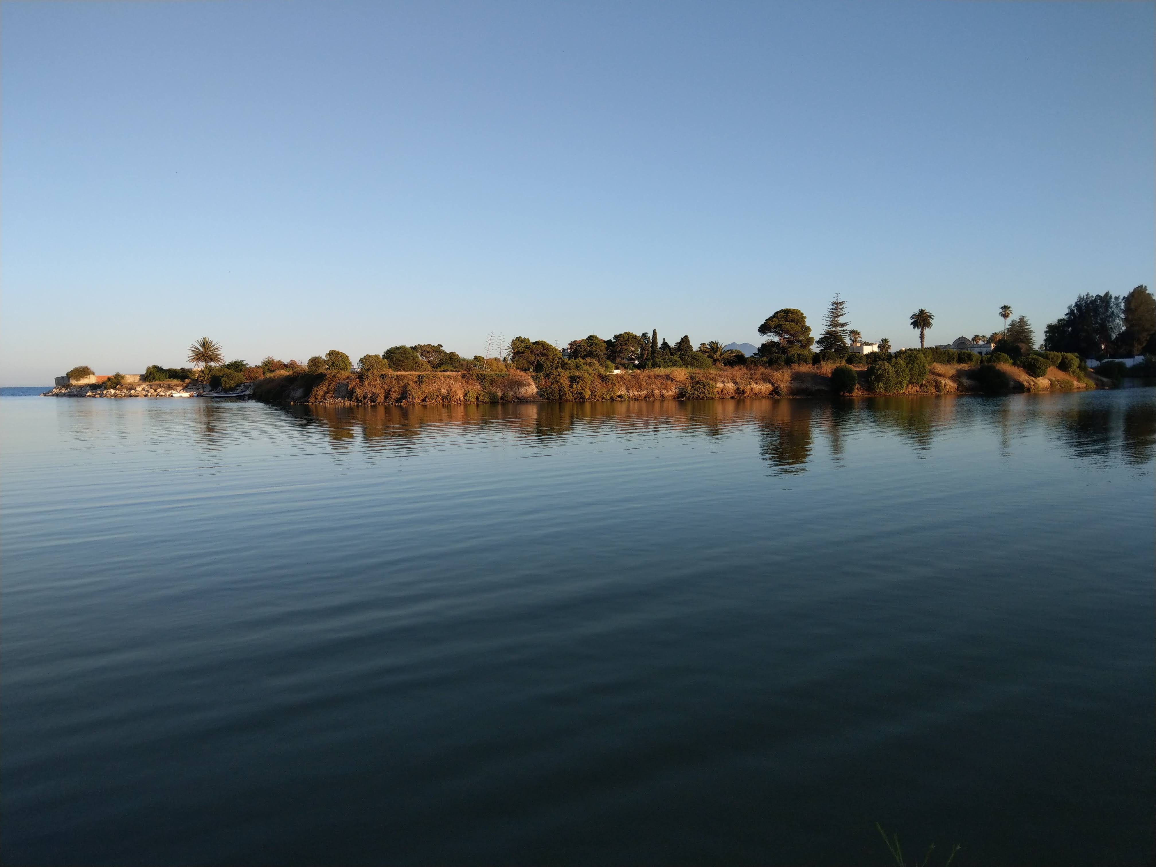
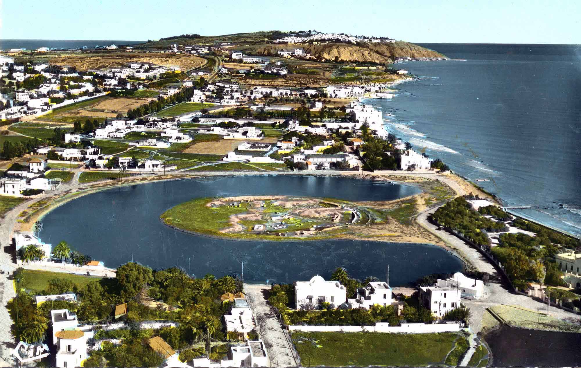
The commercial infrastructure of ancient Carthage centered on a remarkable dual harbor system—the cothon—located on the city’s southeastern shore along the Gulf of Tunis. As Serge Lancel documented in Carthage: A History (Blackwell, 1995), the outer rectangular merchant harbor measured approximately 150 by 400 meters, encompassing roughly six hectares with a depth of about two meters suited to the shallower drafts of commercial vessels. This basin opened to the sea through a narrow channel roughly twenty meters wide that could be closed with iron chains, controlling both access and customs collection. Behind it lay the famous circular military harbor, or Ilot de l’Amirauté, with its radial arrangement of shipsheds capable of housing 170 to 220 warships. The commercial port itself was lined with quays, warehouses, and docking facilities for the merchant fleet that sustained Carthage’s Mediterranean trade network. Between the sea-filled cothon and the heights of the Byrsa citadel lay the agora—the central marketplace for business and civic assembly—though its precise location remains debated among scholars. Henry Hurst of Cambridge University, directing British excavations during the UNESCO “Save Carthage” campaign (1972–1992), published detailed findings in Excavations at Carthage: The British Mission (Oxford University Press for the British Academy, 1994), documenting the harbor’s construction phases, quayside structures, and evidence of commercial activity. The American team led by Lawrence E. Stager of Harvard University, working under the auspices of the American Schools of Oriental Research, excavated sections of the commercial harbor and the adjacent Tophet sanctuary between 1975 and 1979, revealing the spatial relationship between sacred and commercial zones. On the southeastern slope of Byrsa hill, Lancel’s own excavations uncovered the so-called “Hannibal quarter,” a late Punic residential and commercial district dating to the early second century BCE, featuring a regular orthogonal street grid approximately six meters wide with shops, cisterns, and domestic quarters arranged in insulae—evidence of sophisticated urban planning in the city’s final decades. The German archaeological teams from the University of Hamburg under H. G. Niemeyer (1986–1995) and later from the German Archaeological Institute in Rome excavated the “Quartier Magon” along the coast, uncovering a fifth-century BCE rampart and residential structures that attested to the density of occupation in the commercial waterfront zone. Richard Miles, in Carthage Must Be Destroyed: The Rise and Fall of an Ancient Civilization (Viking, 2010), described the overall harbor complex as “an engineering marvel” that reflected Carthage’s identity as a commercial civilization whose physical infrastructure was built to serve trade above all other functions.
The decorative and material culture of Carthage’s commercial spaces reflected a civilization in which trade, religion, and artistic production were deeply intertwined. The Tophet sanctuary of Salammbô, situated adjacent to the commercial harbor, yielded thousands of limestone votive stelae dedicated to the deities Tanit and Baal Hammon, many bearing the distinctive “sign of Tanit”—a schematic anthropomorphic figure consisting of a triangle surmounted by a disc separated by a horizontal bar with upturned terminals. As Josephine Crawley Quinn and Nicholas Vella discussed in The Punic Mediterranean: Identities and Identification from Phoenician Settlement to Roman Rule (Cambridge University Press, 2014), these stelae evolved stylistically over the centuries, incorporating Egyptianizing, Greek, and indigenous Libyan motifs that chart the cosmopolitan visual culture of a trading city open to artistic influences from across the Mediterranean. Carthaginian coinage, first minted in the late fifth century BCE to pay mercenary soldiers in Sicily, developed into a sophisticated numismatic tradition documented by G. Kenneth Jenkins and R. B. Lewis in Carthaginian Gold and Electrum Coins (Royal Numismatic Society, 1963). The gold staters and electrum coins featured images of the goddess Tanit—identified with the Greek Persephone—wreathed in grain ears on the obverse, with a standing horse or palm tree on the reverse, symbols that simultaneously evoked agricultural wealth and Phoenician identity. Bronze and silver issues circulated widely in the western Mediterranean and have been recovered archaeologically from Sicily to Iberia, serving as tangible instruments of Carthaginian commercial exchange. Standardized stone and metal trade weights, often inscribed with Punic characters indicating their value, have been recovered from the commercial quarter and are preserved in the Carthage National Museum on Byrsa hill. Punic amphora stamps—impressed marks identifying the workshop, contents, or merchant—appear on the mass-produced transport vessels that carried Carthaginian wine, olive oil, and fish sauce (garum) across the Mediterranean; as M. E. Aubet observed in The Phoenicians and the West: Politics, Colonies and Trade (Cambridge University Press, 2001, 2nd ed.), these stamps represent a form of commercial branding that facilitated long-distance trade. The Bardo National Museum in Tunis preserves the richest collection of Punic material culture, including terracotta grimacing masks used in funerary and apotropaic rituals, painted ostrich eggs employed as grave goods, and the famous “stele of the priest and the child” from the Tophet. Carthaginian artisans also produced fine glass beads, ivory carvings, and gold jewelry found in tombs across the western Mediterranean—objects that doubled as trade goods and personal ornaments, embedding aesthetic value within the circuits of commercial exchange.
Carthage occupied one of the most strategically consequential positions in the ancient Mediterranean: a promontory on the northeastern coast of modern Tunisia, projecting into the narrow strait that separates Africa from Sicily and divides the Mediterranean into its eastern and western basins. As B. H. Warmington emphasized in Carthage (Robert Hale, 1960; Penguin, 1964), this geographic position gave Carthage effective control over the central Mediterranean narrows, enabling it to regulate—and tax—the maritime traffic passing between the two halves of the sea. The city’s topography reinforced its commercial and defensive advantages. The Byrsa citadel, rising some sixty meters above the coastal plain, dominated the surrounding landscape and housed the city’s temples, administrative buildings, and, in its final phase, the densely packed residential and commercial quarter excavated by Lancel. Below Byrsa, the urban fabric extended southward and eastward toward the harbors, with residential neighborhoods, artisan workshops, and commercial streets radiating outward from the agora. The commercial harbor opened onto the Gulf of Tunis and ultimately onto the open Mediterranean, while a lagoon—the ancient Lake of Tunis—provided additional sheltered anchorage to the west. The relationship between the commercial and military harbors was itself a statement of urban priorities: as Dexter Hoyos noted in The Carthaginians (Routledge, 2010), the merchant port occupied the outer position closest to the sea, ensuring that commercial vessels had the most direct access, while the naval harbor lay behind it in a more protected position. Carthage’s hinterland was equally critical to its commercial power. The Cap Bon peninsula to the east—one of the most fertile regions of North Africa—supplied the grain, wine, olives, and fruit that constituted major export commodities. Mago’s agricultural treatise, a twenty-eight-volume work in Punic that the Roman Senate ordered translated into Latin by Decimus Junius Silanus after the destruction of Carthage in 146 BCE, attested to the sophistication of Carthaginian agronomy, as Columella and Pliny the Elder both cited it extensively in their own works. The road network connected Carthage to its North African dependencies and allied cities—Utica, Hadrumetum (modern Sousse), Thapsus, and Leptis Minor—while maritime routes radiated outward to Carthage’s colonial and trading posts across the western Mediterranean: Motya and Panormus in Sicily, Caralis and Nora in Sardinia, Ibiza in the Balearics, and Gades (Cádiz) on the Atlantic coast of Iberia.
Carthage was, above all, a trading civilization—founded by Phoenician merchants from Tyre around 814 BCE, according to the traditional dating preserved by Timaeus and later by Roman historians. As M. E. Aubet argued in The Phoenicians and the West (Cambridge University Press, 2001), the Phoenician expansion westward was driven primarily by commercial imperatives: the search for metals, agricultural land, and strategic harbors along the trade routes linking the Levant to the mineral wealth of Iberia and beyond. Carthage’s very name—Qart Hadasht, “New City”—signaled its founding as a commercial colony, and its political institutions reflected this mercantile orientation. The suffetes, two annually elected chief magistrates whose title derived from the Semitic root meaning “judges,” served functions analogous to both executive and commercial-judicial roles, as Aristotle observed in his Politics (Book II, Chapter 11) when he compared Carthage’s constitution favorably with those of Sparta and Crete. The Senate (the adirim) was dominated by wealthy merchant families whose commercial interests shaped state policy, and as Richard Miles documented in Carthage Must Be Destroyed (Viking, 2010), the great aristocratic houses—the Magonids in the sixth and fifth centuries BCE, later the Barcids—derived their political power from mercantile wealth. Private trade and merchant partnerships were central to Carthaginian economic life. Although the precise ratio of state-controlled to private commerce remains debated, the evidence suggests that aristocratic merchants organized much of the long-distance trade on their own account, forming partnerships and employing agents in distant ports. Carthaginian traders maintained permanent quarters in Athens, Syracuse, and other major commercial centers—including the Vicus Africus district of Rome itself—while foreign merchants from Rhodes, Corinth, and Etruria were welcomed in Carthage’s own markets. The commercial treaties between Carthage and Rome, documented in extraordinary detail by the Greek historian Polybius (Histories, Book III, Chapters 22–25), provide the clearest evidence of how Carthage regulated trade through bilateral agreements. The first treaty, dated by Polybius to 509/508 BCE, delimited zones of exclusive commercial operation: Roman and allied merchants were prohibited from sailing beyond the “Fair Promontory” (possibly Cap Bon) unless driven by storm, while trade in the Carthaginian sphere was to be conducted only in the presence of a public herald or notary—a remarkable early example of regulated commercial exchange. A second treaty in 348 BCE further restricted Roman trading access while opening Carthaginian markets in Sicily and North Africa under defined conditions. The Periplus of Hanno, a fifth-century BCE account of a Carthaginian naval expedition down the West African coast, represented commercial exploration at its most ambitious: Hanno reportedly established seven colonies along the Moroccan coast and explored as far as the Gulf of Guinea, motivated at least in part by the desire to secure access to West African gold sources. Brian Warmington, in Carthage (1960), argued that Carthage’s greatness derived from its unique position as intermediary between the metal-rich western Mediterranean and the markets of the eastern Mediterranean and Near East. The city’s destruction by Rome in 146 BCE, after three devastating Punic Wars, eliminated the greatest commercial rival Rome ever faced.
Carthage functioned as the central node in a trading network that spanned from the Atlantic coast of Africa to the Levant and from Britain to the Sahara. As Warmington documented in Carthage (1960) and Miles elaborated in Carthage Must Be Destroyed (2010), the city’s commercial power rested on its role as intermediary—purchasing raw materials from producers at the western and southern peripheries of the known world and redistributing them to consumers across the Mediterranean basin. The most iconic Carthaginian trade good was Tyrian purple dye, manufactured from the murex sea snail (Bolinus brandaris and Hexaplex trunculus) using techniques inherited from Phoenician Tyre. While no evidence of purple-dye production has been found at Carthage itself, archaeological excavations at Kerkouane on the Cap Bon peninsula and at Djerba in the Gulf of Gabes have revealed massive mounds of crushed murex shells, and Strabo specifically mentions the purple dye-works of Djerba and the nearby city of Zouchis. The dye was extraordinarily valuable—worth fifteen to twenty times its weight in gold by some ancient estimates—and the purple-dyed textiles produced in Punic workshops commanded premium prices throughout the Mediterranean. Metals constituted the second great pillar of Carthaginian trade. Silver from the mines of southeastern Iberia, accessed through the Phoenician and later Carthaginian colony of Gades (Cádiz), flowed through Carthage in enormous quantities; Polybius reported that the mines near Carthago Nova (Cartagena) employed 40,000 workers and yielded 25,000 drachmas per day. Tin, essential for bronze production, was sourced from Iberia and possibly from as far as Cornwall in Britain, as Diodorus Siculus reported Phoenician voyages to the “Tin Islands.” Gold from West Africa reached Carthage via trans-Saharan caravan routes and the Atlantic coastal stations established during voyages like Hanno’s Periplus. Aubet demonstrated in The Phoenicians and the West (2001) that this metals trade drove the entire Phoenician and Carthaginian expansion into the western Mediterranean. Agricultural products from Carthage’s fertile North African hinterland—grain, wine, olive oil, figs, pomegranates, and almonds—were traded in bulk, as attested by the ubiquitous Punic transport amphora that has been recovered archaeologically from sites across the western Mediterranean, from Massilia (Marseille) to Corsica, Sardinia, and Rome. Two Punic shipwrecks have yielded cargoes of fish sauce (garum), wine, and olives, confirming the literary evidence. Manufactured goods—fine pottery, glass beads, ivory carvings, metalwork, and jewelry—were both produced in Carthaginian workshops and re-exported from eastern Mediterranean sources. Slaves, acquired through warfare and trade with African and Iberian peoples, represented another significant commodity. Carthaginian coinage, first struck in the late fifth century BCE as documented by Jenkins and Lewis in Carthaginian Gold and Electrum Coins (1963), facilitated these transactions: gold staters, electrum coins, silver shekels, and bronze issues circulated throughout the Carthaginian sphere of influence, with their weight standards calibrated to facilitate exchange with Greek and later Roman monetary systems.