Vijayanagara Bazaars (Hampi)
Hampi, India · Established c. 1336 CE
This site requires authorization to access.
To request access, contact
william.goetzmann@yale.edu
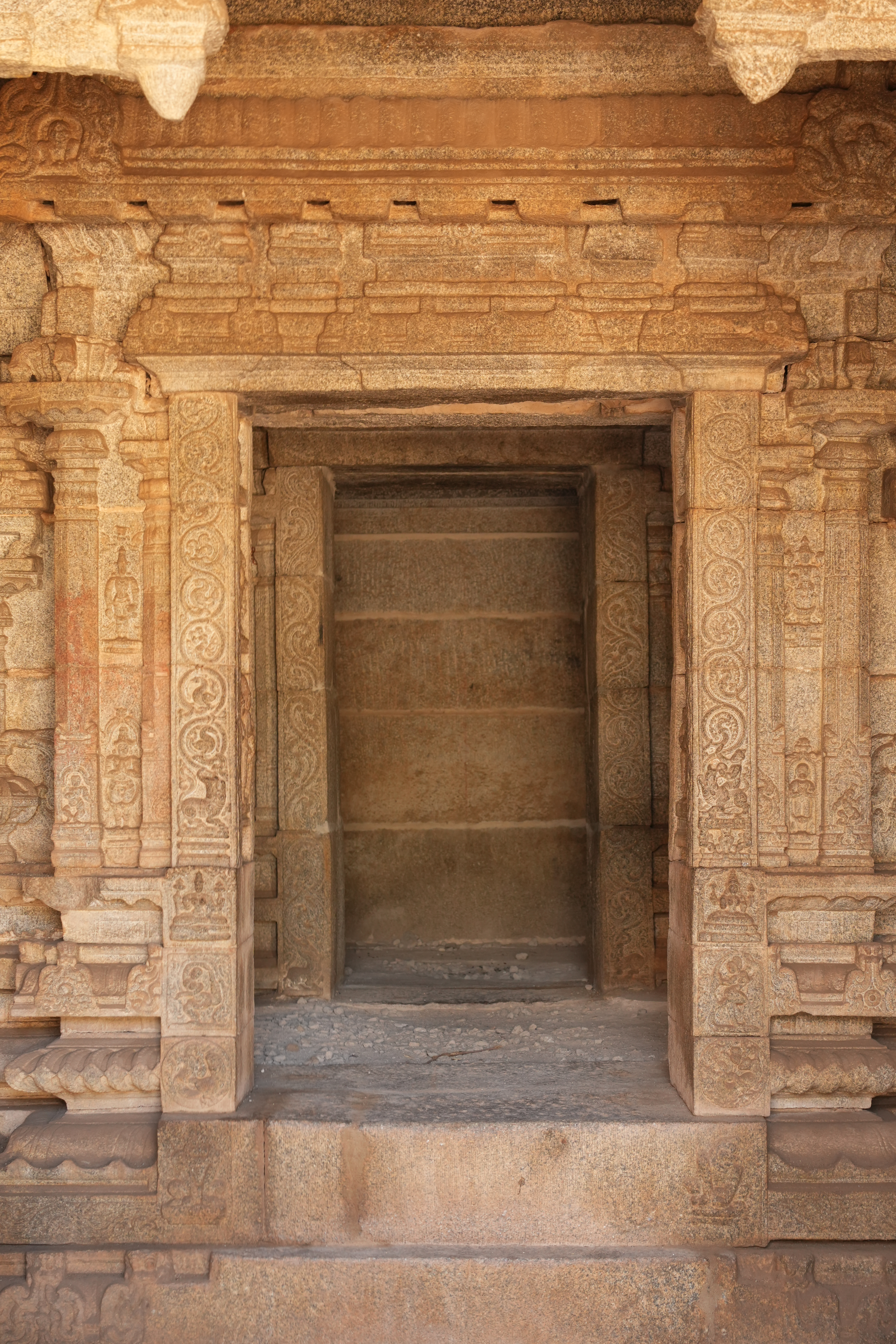
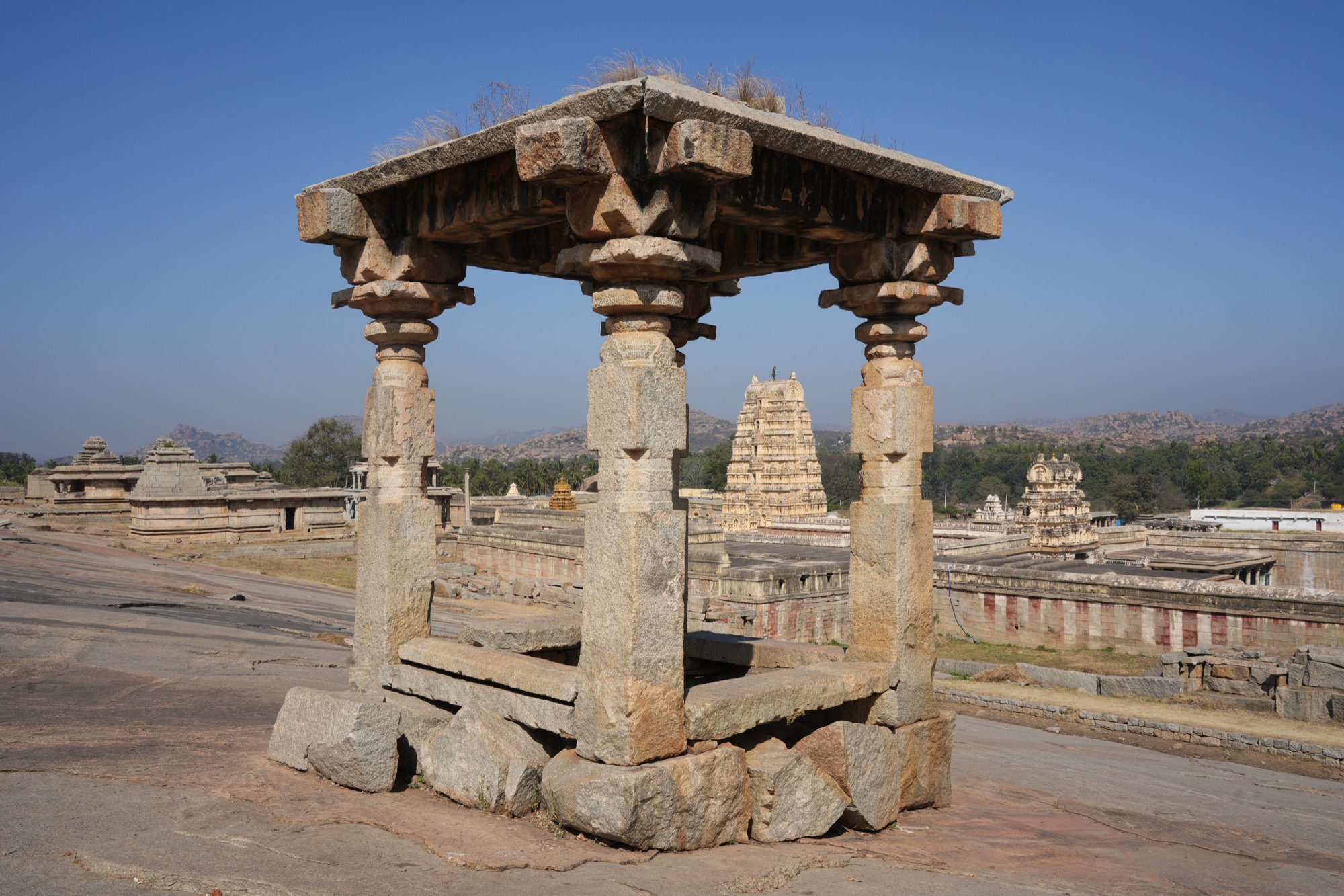
The bazaar streets of Vijayanagara constitute one of the most extensive surviving medieval commercial landscapes in Asia. As John M. Fritz and George Michell document in their comprehensive survey Hampi Vijayanagara (2001), the capital’s market infrastructure comprised multiple stone-paved processional streets lined with granite pillared mandapas that served as shops, warehouses, and merchant lodgings. The principal artery, Hampi Bazaar (also called Virupaksha Bazaar), stretches nearly one kilometer eastward from the towering gopura of the Virupaksha Temple, with double rows of stone platforms flanking the central thoroughfare. Fritz and Michell identified at least five major bazaar streets: the Krishna Bazaar adjacent to the Krishna Temple, the Vittala Temple Bazaar leading to the celebrated Vitthala complex, the Achyutaraya Temple Bazaar (approximately half a kilometer long and fifty meters wide, among the best-preserved examples), and the Sule Bazaar in the urban core. Burton Stein, in Vijayanagara (The New Cambridge History of India, 1989), emphasized that these bazaars were not merely commercial corridors but ritual processional routes linking the empire’s great temple complexes. The mandapa structures—raised granite platforms with colonnaded superstructures—provided standardized commercial space, with each unit roughly uniform in dimension, suggesting centralized planning by the Vijayanagara court. George Michell, in The Vijayanagara Courtly Style (1992), argued that the monumental scale of these bazaars reflected the empire’s deliberate policy of channeling international trade through its capital. Today more than 1,600 monuments survive across the 41.5-square-kilometer site, which was inscribed as a UNESCO World Heritage Site in 1986 in recognition of its outstanding universal value as the ruined capital of the last great Hindu kingdom.
The artistic programs of Vijayanagara’s bazaar temples provide exceptional documentary evidence of the empire’s commercial networks. Inside the Vittala Temple complex, carved granite reliefs depict foreign horse traders—identified by their distinctive headgear and attire as Persian and Arabian merchants—leading horses into the city, a visual record of the empire’s most lucrative import trade. George Michell and Phillip B. Wagoner, in their study Vijayanagara: Architectural Inventory of the Sacred Centre (2001), catalogued these sculptural panels as key evidence of the cosmopolitan character of Vijayanagara commerce. The celebrated stone chariot (Garuda shrine) in the Vittala Temple courtyard, a monolithic granite structure in the form of a temple car with functional stone wheels, stands as perhaps the single most iconic monument of Vijayanagara artistry and was almost certainly intended to impress the foreign merchants who frequented the adjacent bazaar. Within the Virupaksha Temple, mural paintings dating to the sixteenth century depict scenes of court life, religious processions, and episodes from the Ramayana, providing visual context for the ceremonial functions of the bazaar street outside. Anna Dallapiccola, in South Indian Paintings: A Catalogue of the British Museum Collection (2010), analyzed the stylistic connections between Vijayanagara temple murals and the broader Deccani painting tradition. The so-called musical pillars of the Vittala Temple—granite columns engineered to produce distinct tonal notes when struck—exemplify the extraordinary technical sophistication of Vijayanagara sculptors, as Michell discussed in Architecture and Art of Southern India: Vijayanagara and the Successor States (1995). Taken together, these artistic programs transformed the bazaar temples from mere commercial waypoints into immersive environments that communicated the empire’s wealth, piety, and cosmopolitan reach to every visiting merchant.
Vijayanagara occupied one of the most dramatic natural settings of any premodern metropolis: a vast landscape of granite boulders and hills along the southern bank of the Tungabhadra River in what is now Karnataka. The Persian ambassador Abdur Razzaq, visiting in 1442, described seven concentric rings of fortification walls enclosing progressively more exclusive zones of habitation and commerce, an account analyzed by Burton Stein in Vijayanagara (1989) as evidence of a highly stratified urban geography. By approximately 1500 CE, Vijayanagara had grown into what many scholars consider the world’s second-largest city, with a population estimated at 500,000 inhabitants. John M. Fritz, George Michell, and M. S. Nagaraja Rao, in their archaeological survey The Royal Centre at Vijayanagara: Preliminary Report (1984), mapped the urban core and demonstrated how the bazaar streets served as the connective tissue linking the Sacred Centre (temple zone) to the Royal Centre (palatial zone) and the suburban quarters beyond. The city’s strategic position on overland trade routes connecting the Malabar coast spice ports to the Deccan plateau made it a natural entrepot, as Sanjay Subrahmanyam explored in The Political Economy of Commerce: Southern India 1500–1650 (1990). The Tungabhadra River provided not only water supply and irrigation for the surrounding rice-growing hinterland but also a navigable corridor that facilitated the movement of bulk goods. Kathleen Morrison, in Fields of Victory: Vijayanagara and the Course of Intensification (1995), demonstrated through archaeological and environmental analysis how the empire’s elaborate canal and reservoir systems supported the dense population that sustained the bazaar economy. The resulting urban landscape—temples, bazaars, fortifications, and hydraulic works woven through a primordial boulder-strewn terrain—remains without parallel among medieval Asian capitals.
The Vijayanagara Empire (1336–1565) created one of the most commercially vibrant polities in the premodern world, and its capital’s bazaars attracted merchants from across the Indian Ocean. The Venetian traveler Nicolò de’ Conti, who visited around 1420, declared that he had never seen a place to rival it, an account preserved in Poggio Bracciolini’s De Varietate Fortunae and discussed by Joan-Pau Rubiés in Travel and Ethnology in the Renaissance: South India through European Eyes, 1250–1625 (2000). The Persian ambassador Abdur Razzaq, arriving in 1442 from the Timurid court, left a detailed description of the bazaars’ extraordinary wealth and the profusion of precious stones on open display, a source analyzed by John Deyell in Living without Silver: The Monetary History of Early Medieval North India (1990) for its monetary implications. The Portuguese traveler Domingo Paes, writing around 1520, famously reported that diamonds were sold in the bazaars openly, “like peanuts,” and described the scale of the horse trade, accounts compiled in Robert Sewell’s A Forgotten Empire: Vijayanagara (1900), a foundational text still cited by scholars. Fernão Nuniz, another Portuguese chronicler resident in the city around 1535–37, documented the royal monopolies, tax systems, and the presence of diverse merchant communities—Portuguese, Persian, Arab, and Southeast Asian—all operating under royal charter, as examined by Sanjay Subrahmanyam in The Political Economy of Commerce (1990). The empire’s catastrophic defeat at the Battle of Talikota (also called Rakkasa-Tangadi) on 26 January 1565 against a coalition of Deccan sultanates led to the systematic destruction and abandonment of the capital. Burton Stein, in Vijayanagara (1989), interpreted the battle and its aftermath as marking the end of an era of Hindu imperial sovereignty in South India, though subsequent scholarship by Hermann Kulke and Dietmar Rothermund in A History of India (1986, revised editions) has nuanced this assessment by emphasizing continuities in regional commerce.
The bazaars of Vijayanagara facilitated trade across an extraordinary range of commodities, from bulk agricultural goods to the most precious stones known to the premodern world. The Krishna Bazaar served as the principal center for the diamond and precious-stone trade, drawing on the famous Golconda mines to the northeast; Sanjay Subrahmanyam, in The Political Economy of Commerce: Southern India 1500–1650 (1990), traced the merchant networks that channeled rough diamonds through Vijayanagara to cutting centers and international markets. The Vittala Temple Bazaar was closely associated with the horse trade, the empire’s single most expensive import: Arabian and Persian warhorses arrived via the Malabar and Konkan coast ports at extraordinary premium prices. Simon Digby, in War-Horse and Elephant in the Delhi Sultanate (1971), established the broader framework for understanding the strategic importance of the horse trade in South Asian state-building, a theme extended to Vijayanagara by Phillip B. Wagoner in Tidings of the King: A Translation and Ethnohistorical Analysis of the Rāyavācakamu (1993). Spices—particularly pepper, cardamom, and cinnamon—flowed through the capital from the Malabar coast hinterland, while textiles, rice, metals (iron and steel from the Deccan), and sugar were traded in the Sule Bazaar and other urban markets. A remarkable inscription dated 1545, studied by Noboru Karashima in A Concordance of the Nāyaka Inscriptions (2002), records weekly tax collection schedules and per-shop levies in the bazaars, providing rare quantitative evidence of the empire’s commercial regulation. International merchant communities—including the Tamil Ayyavole and Manigramam guilds with centuries-old trading charters—operated alongside Portuguese, Persian, and Arab factors, as Meera Abraham documented in Two Medieval Merchant Guilds of South India (1988). The convergence of local agricultural surplus, transit trade in luxury goods, and the empire’s systematic fiscal extraction made Vijayanagara’s bazaars among the most commercially dense marketplaces in the fifteenth- and sixteenth-century world.